Subject: North America
Period: 1700 (dated)
Publication:
Color: Hand Color
Size:
23.5 x 17.7 inches
59.7 x 45 cm
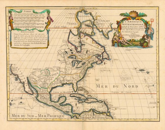
This historically important map made three significant contributions to the cartography of North America. First, it was the first map to revert back to the peninsular form for California, even before the publication of Kino's report. Although on close inspection one can see a small gap at the head of the Gulf of California, leaving open the possibility that California might still be an island. Delisle's second contribution to North American cartography was a more accurate rendition of the Great Lakes region. Third, Delisle corrected the position of the lower Mississippi River, moving the mouth of the river from an area near Galveston Bay to a more correct location in Louisiana. This is an example of the 5th state, published 1707-08, with the note below the cartouche providing Louis Renard the right to sell the map on the Amsterdam market.
References: Mercator's World Vol. 6, No. 4, pp. 44-49; Tooley (Amer) p. 19, #29; Wheat [TMW] #79.
Condition: A
Sharp impression and attractive color. Damp stains in margins, well away from map. Bit of light, unobtrusive, soil in map, still very good.