Catalog Archive
Auction 109, Lot 712

"Carte Generale de la Partie de la Nouvelle Zelande Reconnue par le Capitaine de Fregate Dumont D'Urville…", Dumont d'Urville, Jules Sebasian Cesar

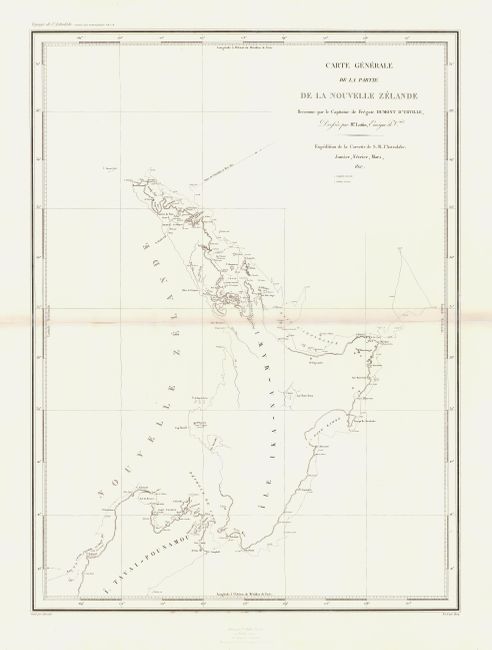
Subject: New Zealand

Period: 1827 (dated)

Publication: Voyage de la Corvette l' Astrolabe

Color: Black & White

Size:
17.2 x 23 inches
43.7 x 58.4 cm
Download High Resolution Image
(or just click on image to launch the Zoom viewer)

Fine early chart of New Zealand's north island and a part of the south island. It shows the 1827 track of the Astrolabe. Only the coastlines that were explored are shown. Dumont d'Urville was a French navigator who led an important expedition to the Pacific aboard the Astrolabe (named in memory of La Perouse's flagship) and made significant contributions to the mapping of New Zealand. This chart was made in conjunction with Victor Charles Lottin. The map was published in 1833-34.

References: Map Collector #43, pp. 22-24.

Condition: B

Centerfold slightly toned and reinforced with Japanese tissue.

Estimate: $400 - $450

Sold for: $240

Closed on 12/1/2004

Archived