Catalog Archive
Auction 109, Lot 701

"Carte de la Cote N.O. de l'Amerique et de la Cote N.E. de l'Asie, Reconnues en 1778 et 1779…", Cook/Benard

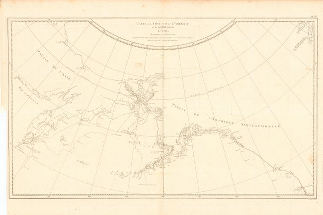
Subject: North Pacific Ocean

Period: 1785 (published)

Publication:

Color: Black & White

Size:
26 x 15.2 inches
66 x 38.6 cm
Download High Resolution Image
(or just click on image to launch the Zoom viewer)

This chart details Cook's 1778 explorations and the 1779 work by Clerke undertaken after Cook's death in the Sandwich Islands in February 1779. Centered on the Bering Straits the chart extends from Kamchatka to Alaska, Nootka and south to Cape Gregory. A portion of Hudson Bay is charted at upper right. From the first French edition of Cook's Third Voyage.

References:

Condition: A

Folding, as issued. Delicate impression on thick hand laid paper with original margins. One light foxing mark in blank area above the Bering Strait.

Estimate: $300 - $400

Unsold

Closed on 12/1/2004

Archived