Catalog Archive
Auction 109, Lot 687

"Guinea Propria, nec non Nigritiae vel Terrae Nigrorum Maxima Pars…", Haas/Homann Heirs

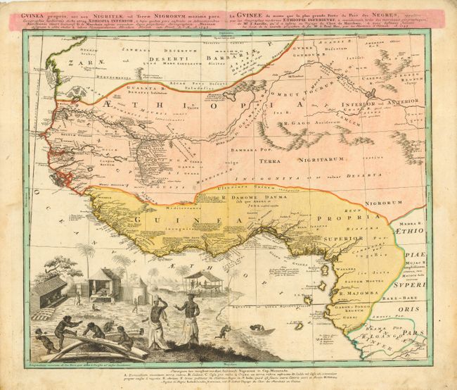
Subject: Africa - Western

Period: 1743 (dated)

Publication:

Color: Hand Color

Size:
22 x 19 inches
55.9 x 48.3 cm
Download High Resolution Image
(or just click on image to launch the Zoom viewer)

This remarkable map is one of the most detailed maps of West Africa during the mid eighteenth century. Information is confined only to those regions that were well known and is particularly well delineated along the Niger River and the coast where there are extensive notations. The map is embellished with a large vignette of a native village with the distance scales engraved onto elephant tusks representing this important trade commodity of the region. A key at the bottom of the map identifies the various peoples and types of habitats.

References:

Condition: B

Original color. Light soil in map.

Estimate: $350 - $425

Sold for: $250

Closed on 12/1/2004

Archived