Subject: Asia - South and Southeast
Period: 1780 (circa)
Publication:
Color: Hand Color
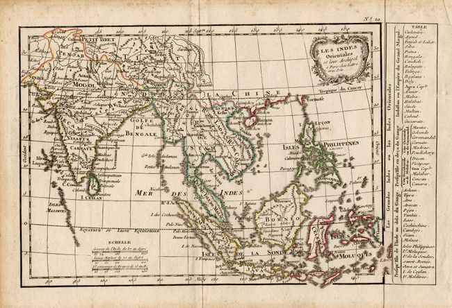
Two copper engraved maps. 1) "Les Indes Orientales et leur Archipel...", Jean Lattre, 11.2 x 7.2". Finely engraved chart extending from India westward to include all of the East Indies, the Philippines, Borneo and part of New Guinea. Names Siam, Laos, Tibet, Penjab, Mogol, and all the major islands of the East Indies. Shell-style title cartouche and three distance scales. Strip of paper pasted at right side gives place names and region, as issued.
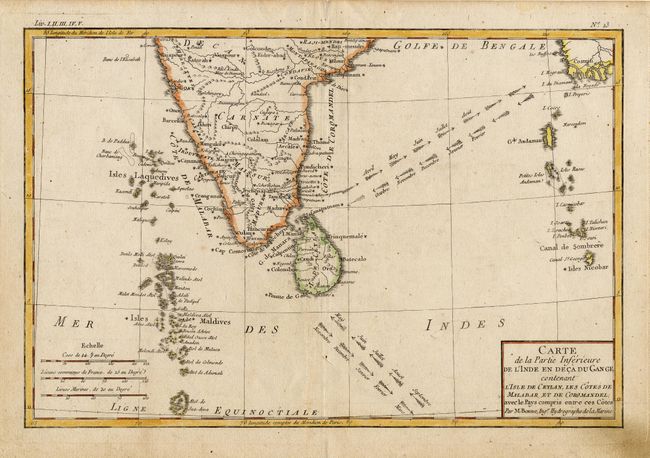
2) "Carte de la Partie Inferieure de l' Inde en deca du Gange…Ceylan…Malabar…Coromandel…", Rigobert Bonne, 12.7 x 8.5". An attractive map of southern India, Sri Lanka and the islands in the Indian Ocean. The prevailing winds are shown between India and Mayanmar, and marked with the months of the year.
References:
Condition: B
Both lightly toned and a trace of foxing, else very good. Full margins on both.