Catalog Archive
Auction 109, Lot 642

"Map of the Peninsula of India, from the 19th Degree of North Latitude to Cape Comorin", Wyld, James
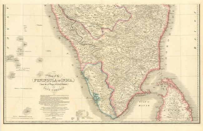
Subject: India

Period: 1838 (dated)

Publication: New General Atlas

Color: Hand Color

Size:
32 x 19.5 inches
81.3 x 49.5 cm
Download High Resolution Image
(or just click on image to launch the Zoom viewer)

Impressive two-sheet map of India with superb detail throughout. Original outline color shows the British Possessions, the Rajah of Mysore, the Marhatta Countries, the Nizam's Dominions, the Rajah of Sittarra, and the Travancore. Size is for each sheet. James Wyld was successor to William Faden, one of the luminaries of late eighteenth century publishing in England. Wyld maintained the high standard of graphic and factual excellence that had been established by his predecessor and his maps are among the finest published in the early nineteenth century.

References:

Condition: A

Bit of faint offsetting, still very good.

Estimate: $200 - $250

Unsold

Closed on 12/1/2004

Archived