Catalog Archive
Auction 109, Lot 632
"Carte de la Chine, avec la Tartarie Chinoise, les Pays Conquis Depuis 25 a 30 ans, et les Etats Tributaries de cet Empire", Brion de la Tour, Louis
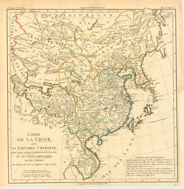
Subject: China and Korea
Period: 1770 (circa)
Publication:
Color: Hand Color
Size:
13.5 x 13.7 inches
34.3 x 34.8 cm
Download High Resolution Image
(or just click on image to launch the Zoom viewer)
(or just click on image to launch the Zoom viewer)