Subject: Ancient World
Period: 1545 (circa)
Publication:
Color: Hand Color
Size:
13.5 x 10 inches
34.3 x 25.4 cm
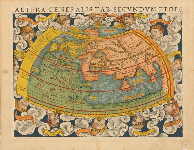
Ptolemaic world map surrounded by clouds and eleven windheads, with their names in banners. The continents are oddly shaped and all connected by a great southern continent Terra incognito secundum Protemeum. There is a very large Taprobana (modern day Sri Lanka) in the Indian Ocean and the Indian subcontinent is severely truncated. Only the northern part of Africa is shown with the Nile originating in a series of lakes in a large mountain range. Latin text on verso.
References: Shirley #76.
Condition: A
Attractive period-correct color and a crisp impression. Professional repair on centerfold and a couple of tiny tears in blank margins. Remnants of hinge tape on verso.