Catalog Archive
Auction 109, Lot 383

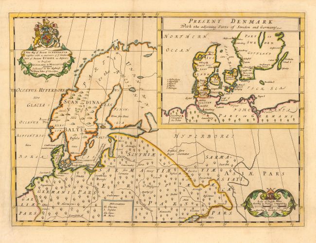
"A New Map of Ancient Scandinavia together with as much more of ye Northern Part of Ancient Europe as Answers to Present Denmark & Moscovia", Wells, Edward

Subject: Europe - Northern

Period: 1700 (circa)

Publication: A New Sett of Maps…

Color: Hand Color

Size:
19.7 x 14.5 inches
50 x 36.8 cm
Download High Resolution Image
(or just click on image to launch the Zoom viewer)

This interesting map covers northeastern Europe and Scandinavia showing the ancient political divisions and place names. In a large inset is a map of "Present Denmark with the adjoining Part of Sweden and Germany." The title cartouche incorporates the royal coat-of-arms and another cartouche encloses the distance scale. Wells, a math professor at Oxford, dedicated the map to his student and heir to the British throne, William - Duke of Gloucester.

References: Phillips (A) #531.

Condition: B

A couple of minor creases and a bit of faint uneven toning, else very good.

Estimate: $220 - $275

Sold for: $275

Closed on 12/1/2004

Archived