Subject: Britain
Period: 1590 (dated)
Publication: Theatrum Orbis Terrarum
Color: Hand Color
Size:
19.2 x 28.5 inches
48.8 x 72.4 cm
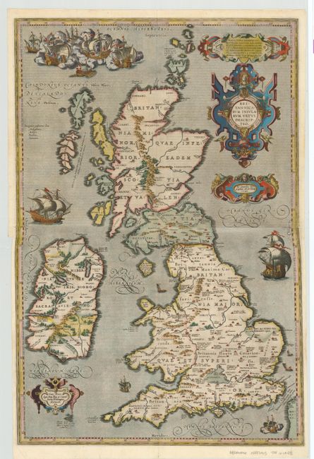
Fabulous two-sheet map of ancient Britain that combines geographical information from Mercator and Saxon with ancient knowledge from Diodorus, Siculus, Plinius, Appianus, Tacitus, Caesar and Strabo. The map is filled with ancient place names, Hadrian's Wall, and Wall of Pius (mislabeled Severi Murus). Probably engraved by Jan Wierix and richly embellished with fabulous large ships and raging sea battles and four elaborate strapwork cartouches. This two-part map only appeared in the early editions; being replaced by a single plate in 1595. Only 400 are estimated by Van den Broecke to have been printed. Latin text on verso.
References: Shirley (BI) #160; Van den Broecke #190-191.
Condition: A
Professionally joined. Couple of minor creases. Remnants of hinge tape on verso.