Catalog Archive
Auction 109, Lot 34

"Carte Magnetique des Deux Hemispheres", Tardieu
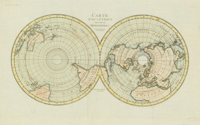
Subject: Polar

Period: 1800 (circa)

Publication:

Color: Hand Color

Size:
13.6 x 7 inches
34.5 x 17.8 cm
Download High Resolution Image
(or just click on image to launch the Zoom viewer)

An unusual twin hemisphere map on a polar projection. Only the continental outlines are delineated with major countries named. Part of the northwest coast of North America is shown by a dotted line and Alaska is in a rudimentary shape. Likewise, the southern coast of Australia is still unknown and Tasmania is thought to be connected to the mainland.

References:

Condition: A

Estimate: $120 - $150

Sold for: $110

Closed on 12/1/2004

Archived