Subject: World
Period: 1778 (circa)
Publication:
Color: Hand Color
Size:
18.2 x 11.2 inches
46.2 x 28.4 cm
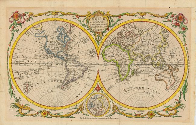
Attractive double-hemisphere world map depicting eighteenth century discoveries. Alaska is shown as an elongated peninsula by dotted lines with a notation of Bering's expedition in 1741. The South Pacific is filled with islands and New Zealand is fully formed. Tasmania is still attached to Australia, which is shown with an unexplored southern coastline. There are numerous notations throughout, and the tracks of Anson and Cook. An inset of the North Pole is tucked between the hemispheres at bottom with the title cartouche balancing the composition at top. Decorative garlands then surround the map, making for a lovely presentation.
References:
Condition: B
Minor mat burn at plate mark. Couple of minor tears extending from fold into map at bottom right, expertly repaired.