Catalog Archive
Auction 109, Lot 301

"An Accurate Map of the Islands of St. Christophers and Nevis in the West Indies", Cary, John

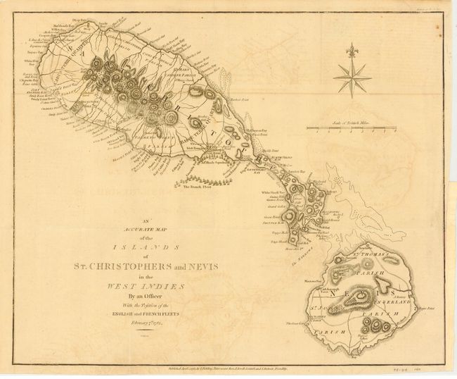
Subject: Lesser Antilles, St. Kitts & Nevis

Period: 1782 (dated)

Publication: European Magazine

Color: Black & White

Size:
15 x 12.2 inches
38.1 x 31 cm
Download High Resolution Image
(or just click on image to launch the Zoom viewer)

Map shows the French Fleet offshore from Irish Town and St. George's Town on St. Christopher. Admiral Hood's Squadron is in a defensive position protecting the towns. The topography of both islands is nicely developed and an abundance of geographical detail is shown. Large compass rose and scale of British Miles. Published in the March 1782 issue of the European Magazine. Maps from this publication are rarely seen on the market. Jolly lists only eleven maps, this being the first.

References: Jolly EUR-1.

Condition: B

Nice impression on thick paper. Folding as issued. Paper laid in margin along binding trim to better accommodate framing. Offsetting, else very good.

Estimate: $150 - $200

Unsold

Closed on 12/1/2004

Archived