Subject: United States - Southwestern
Period: 1859 (circa)
Publication: Atlas of the World
Color: Hand Color
Size:
16 x 13 inches
40.6 x 33 cm
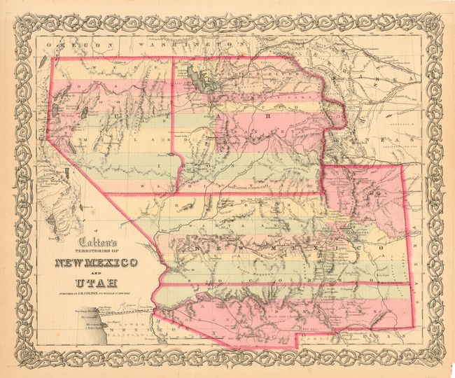
This is the scarce issue of this great map of the American Southwest. Both the territories of Utah and New Mexico are shown in a transitional state with boundaries of the proposed new territories. The proposed territory of Arizona is shown to the south of New Mexico. The newly proposed territory of Nevada is shown taking in the western part of Utah with the border at the 114th meridian, but wandering south-south-west from Preuss L. to form a boundary along the Spanish Trail. To the east of Utah is yet another provisional territory, that of Colona, which became Colorado in 1861. Further east is part of Kanzas and Nebraska. The map locates numerous early exploration routes, mail routes and proposed routes for the Pacific Railroad, and much more. Surrounded by Colton's distinctive scroll border. Dated 1855, and published by Colton (not Johnson & Browning) about 1859. Carl Wheat illustrates an earlier issue of this map as the frontispiece to Volume IV of his monumental "Mapping the Trans-Mississippi West".
References: Wheat (TMW) #832; cf Phillips #816.
Condition: A
Fine original coloring and crisp impression. One thick paper with good margins. Small chip at lower right removes page number. Two insignificant spots in map, else fine.