Subject: United States - Southwestern
Period: 1858 (circa)
Publication: Atlas of the World
Color: Hand Color
Size:
16 x 13 inches
40.6 x 33 cm
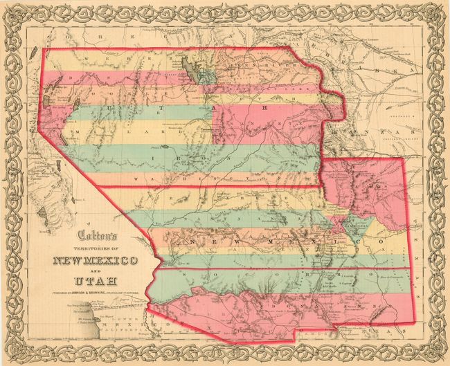
Fine example of a very desirable map that Wheat found important enough to use as the frontispiece to Volume 4 of his Mapping the Transmississippi West. A very interesting map that has New Mexico extending between Texas and California. Utah encompasses all of today's Nevada and extends west to the Continental Divide in today's Colorado, with Fillmore City as its capital. Locates several of Fremont's routes, proposed routes for the Pacific Railroad, the Spanish Trail, mail routes, and much more. Surrounded by Colton's distinctive scroll border. Dated 1855, but published by Johnson & Browning about 1858 based on county development. New Mexico shows ten counties. An increasingly difficult map to find in this state.
References: Wheat (TMW) #832; cf Phillips #816.
Condition: A
Lovely ivory color to paper, fine coloring and impression. Margins trimmed all around to about 1/4" from border.