Subject: Northwestern United States
Period: 1860 (circa)
Publication: Atlas of the World
Color: Hand Color
Size:
16 x 13 inches
40.6 x 33 cm
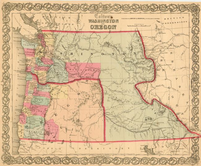
A terrific map of the Pacific Northwest that shows Washington Territory in it's most unusual configuration as it wraps around Oregon. Oregon state has just formed, leaving its eastern half to Washington, which is now shaped as an upside down "L" and touching Utah in the south. Utah's northern border encompasses all of present-day Idaho and parts of Montana and Wyoming. The organized counties of both Oregon and Washington are confined west of the mountain ranges except for Skamania and Walla Walla counties. Published by Johnson and Browning, shortly after Oregon became a state in 1859.
References:
Condition: A
Lovely ivory colored paper, fine coloring and impression. Margins trimmed all around to about 1/4" from border. One small spot in title.