Subject: World
Period: 1660 (circa)
Publication: Historische Chronyck…
Color: Hand Color
Size:
13.7 x 10.2 inches
34.8 x 25.9 cm
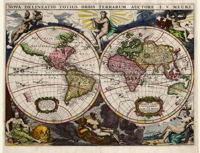
This map is based on Arnold Colom's wonderfully graphic map from the first world maritime atlas. In the Western Hemisphere the Island of California is separated from Nova Albion, which stretches towards Asia and off the map. The western coast of New Zealand appears, as do several other important Pacific islands. Australia is partially mapped and only the southern tip of Tasmania appears. Superb engravings surround the map with six statuesque female allegorical representations of the goddesses of Day and Night and the elements of Fire, Air, Water and Earth. Each hemisphere includes a strapwork cartouche. The Dutch title appears in the cartouche in the Eastern Hemisphere. Meurs' map was later copied by Van der Aa, which is more commonly available.
References: Shirley #417.
Condition: A
Professional and nearly invisible repair of tiny tear barely entering map at bottom centerfold, else very fine.