Subject: Colonial Great Lakes and Canada
Period: 1755 (dated)
Publication:
Color: Hand Color
Size:
23.7 x 18.7 inches
60.2 x 47.5 cm
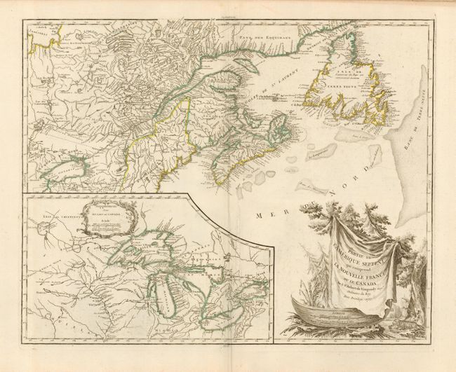
Handsome map of Newfoundland, Nova Scotia, and the entire course of the St. Lawrence River. The most prominent feature of the map is the very large inset of the 1744 Bellin version of the Great Lakes. The large decorative cartouche, featuring a fierce beaver, makes for a very attractive map. Fourth state (Pedley), with the boundaries of the province of Quebec added per the Treaty of Paris and a boundary south of Lake Ontario added per the Treaty of Ft. Stanwix. The cartouche has been re-engraved by Groux, published circa 1778.
References: Kershaw #356; Pedley #459.
Condition: A+
Printed on fine thick paper with wide margins and original outline color. Slight surface soil, still fine.