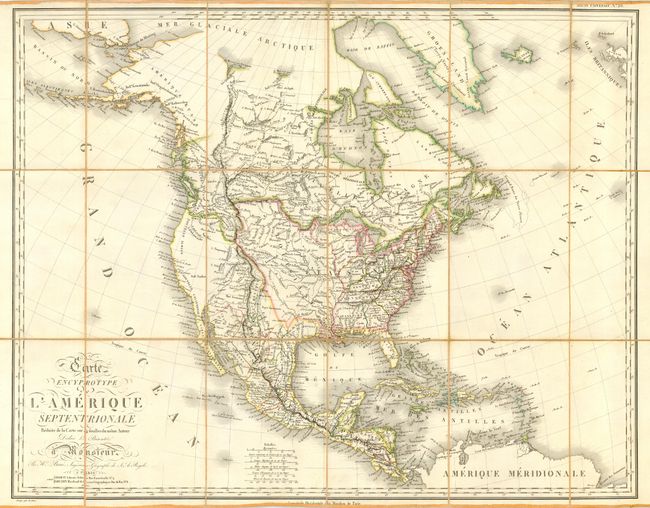
Subject: North America
Period: 1815 (dated)
Publication: Grand atlas universel
Color: Hand Color
Size:
28 x 22 inches
71.1 x 55.9 cm
A remarkable map that Wheat compares to Arrowsmith's map of 1814, here in a segmented case map format. Brue's geography improves upon Lewis & Clark's in the Upper Columbia. He credits Vancouver, Humboldt, Arrowsmith, Pike, Lafora, and Lewis and Clark for the map's geography. This map appears to be a later edition (retaining the 1815 date), which is not described by Wheat. It does not include the Rio de Sn. Felipe of the 1815 edition. Nor does it contain the Rio de las Piramides Sulfureas of the 1819 edition, however, the dotted lines remain. Segmented and mounted on linen. An important map in remarkable condition.
References: Wheat [TMW] #321, Rumsey 4614.032.
Condition: A+
Very fine impression and original coloring. Original paper label pasted on back of linen, in mint condition. One spot on map.