Subject: South and Central Asia
Period: 1640 (circa)
Publication:
Color: Hand Color
Size:
20.5 x 16.5 inches
52.1 x 41.9 cm
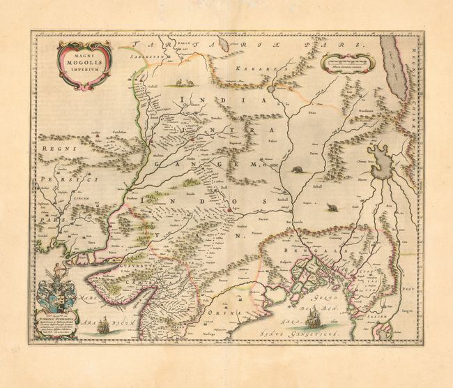
This map depicts the Empire of the Great Moghul, in northern India including the region from Iran to Burma. The important travel route from Kabul to Surat is the most prominent feature of the map. This is the route traveled by the embassy of the Englishman Sir Thomas Roe to the Moghul emperor Jahangir in 1615, derived from a map published by William Baffin in London in 1618. This Dutch version of Baffin's map remained the standard Dutch view of the north part of the subcontinent and central Asia throughout the seventeenth century. Finely decorated with strapwork title and scale of miles cartouches, a dedication with coat of arms, sailing ships, and elephants and camels in the interior.
References:
Condition: B
Lovely original color. Faint damp stain at bottom.