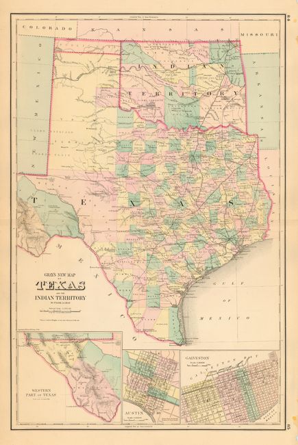
Subject: Texas and Oklahoma
Period: 1875 (dated)
Publication: Atlas of the United States
Color: Hand Color
Size:
15.4 x 23 inches
39.1 x 58.4 cm
Terrific double-page map filled with detail. The state's growth is evident with only Young, Bexar and Pecos Territories remaining unorganized. Wegefarth County, shown in Young Territory, was established in 1873 and abolished in 1876 by the legislature when they established the other Panhandle counties. Many railroads end between cities as the map shows the exact progress to date. Details include numerous railroads, cities, towns, forts, springs, and much more. Three large insets include city plans for Austin and Galveston, and a detail of the Western Part of Texas. In Indian Territory the Public Lands are limited to the western panhandle. Copyright date 1875, but likely published circa 1883 based on county development.
References:
Condition: A
Nice impression and coloring. Small nick of missing paper at margin, well away from map image.