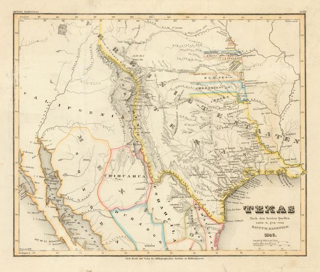
Subject: Texas
Period: 1846 (dated)
Publication: Meyer's Handatlas
Color: Hand Color
Size:
13.9 x 11.5 inches
35.3 x 29.2 cm
Scarce early edition of this map of the Republic of Texas, shown here with the western boundary along the Rio Grande extending to Wyoming in the north. The northwestern boundary is undefined with Indian Territories depicted north of the Arkansas River. The map provides excellent detail of forts, settlements, roads and exploration routes, including those of Long, Gregg, Pike, and Fremont. Later editions of this map show the state of Texas with defined borders.
References: Phillips (M) p. 844; cf. Day #1459 (1850 ed.)
Condition: B
Original color. Light soil and minor creases in map. Tears in blank margins closed with archival tape on verso.