Subject: New York
Period: 1855 (published)
Publication:
Color: Black & White
Size:
35 x 25 inches
88.9 x 63.5 cm
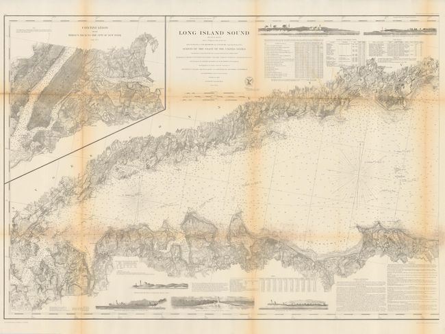
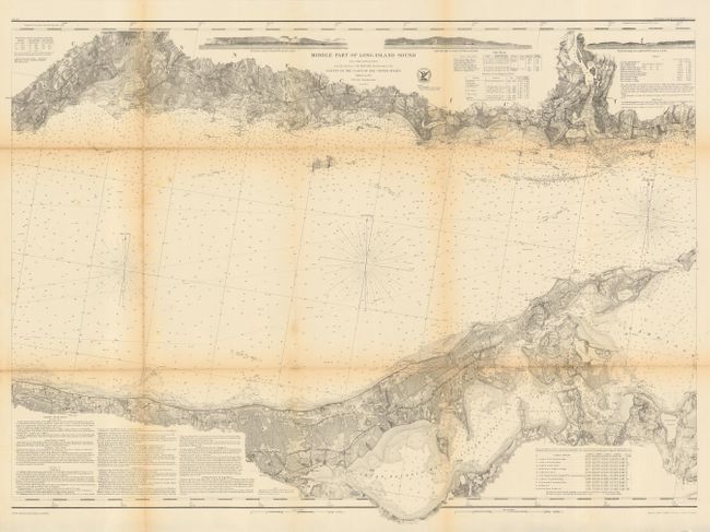
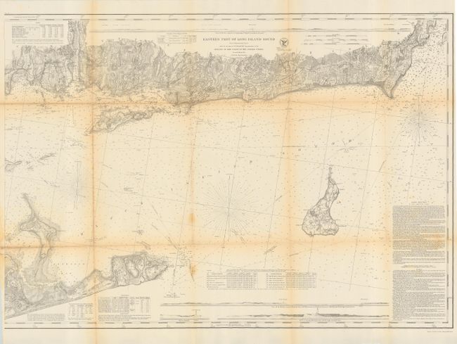
Set of three matching maps covering the entire island in minute detail. The maps are: "Long Island Sound, (Western Sheet)"; "Eastern Part of Long Island Sound" and "Middle Part of Long Island." Charts show coastal topography with many depth soundings, harbors, bays, rivers, & inlets. Includes sailing directions & navigational notes on dangers, reefs, rocks, shoals, lighthouses, bottoms & current stations. With numerous horizontal landfall approach views, and vignettes of lighthouses. All are from a Trigonometrical Survey under the direction of F.R. Hassler Superintendent of the Survey of the Coast of the United States, second edition 1855. Each approximately the size given above.
References: Phillips (M) p. 363
Condition: B
Issued folding, all now backed with archival tissue. All toned along folds.