Catalog Archive
Auction 108, Lot 201

"Diagram of the Surveying District South of Tennessee", U.S. Gov't Printing Office

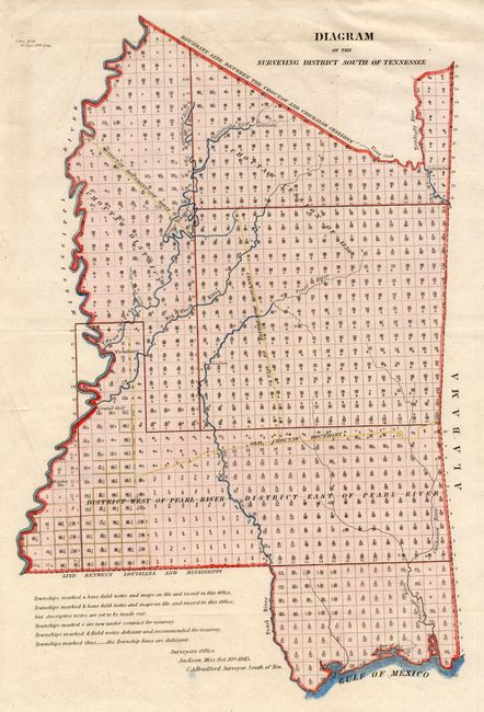
Subject: Mississippi

Period: 1845 (dated)

Publication:

Color: Hand Color

Size:
11 x 16.8 inches
27.9 x 42.7 cm
Download High Resolution Image
(or just click on image to launch the Zoom viewer)

An uncommon and interesting survey map of the region of present-day Mississippi based on work completed by C.A. Bradford in1838 and updated to 1845. It presents the official surveying progress throughout Mississippi, utilizing a series of letters and icons. It shows lands ceded by the Choctaw Indians in1830, as well as the old tribal boundaries of 1822. The northern boundary is labeled Boundary Line Between the Choctaw and Chickasaw Cessions. Only a handful of towns are identified, such as Jackson, Vicksburg and Columbus.

References:

Condition: A+

Issued folded, now pressed.

Estimate: $150 - $180

Sold for: $130

Closed on 9/29/2004

Archived