Catalog Archive
Auction 108, Lot 193

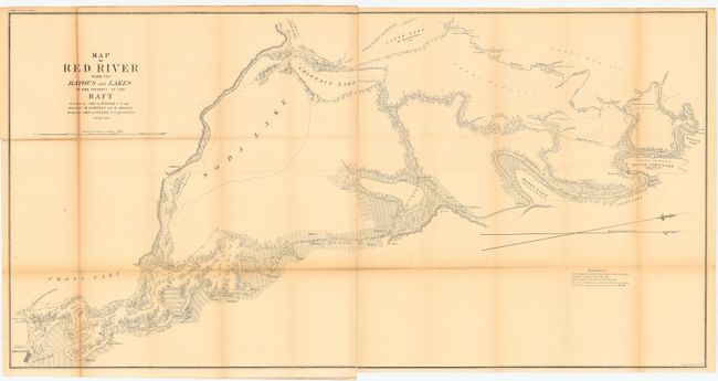
"Map of Red River with its Bayous and Lakes in the Vicinity of the Raft", U.S. State Surveys

Subject: Louisiana

Period: 1855 (dated)

Publication:

Color: Black & White

Size:
46 x 23.5 inches
116.8 x 59.7 cm
Download High Resolution Image
(or just click on image to launch the Zoom viewer)

Shows soundings in the Red River from Shreveport to its confluence with Red Bayou. The 13-mile length of the river is marked and tributaries, topography, and adjacent lakes are indicated. Ownership of numerous land holdings are also noted on this detailed chart.

References:

Condition: B

Overall light toning with heavier toning along two folds. Issued folding, now backed with archival tissue.

Estimate: $80 - $100

Sold for: $95

Closed on 9/29/2004

Archived