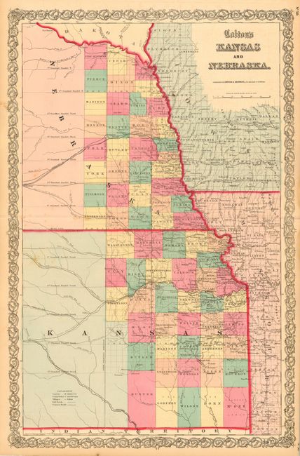
Subject: Kansas and Nebraska
Period: 1857 (dated)
Publication: Atlas of the World
Color: Hand Color
Size:
16.7 x 25.5 inches
42.4 x 64.8 cm
Early map in a vertical configuration covering only the eastern quarter of the territories. Thirty-three counties are organized in Nebraska and 37 in Kansas. The Santa Fe Road originates in Kansas City and The Route to Denver City is shown beginning at Doniphan, near Atchison. The proposed Pacific Railroads are shown but there are no completed lines within the territories. There is no sign of Wichita, and Topeka is just a little town, while the capital is shown as Lecompton. Published by Johnson & Browning in 1860.
References:
Condition: B
Bit of very unobtrusive foxing. Tiny fold separation in blank margin repaired with archival tape.