Subject: United States - Southwestern
Period: 1855 (dated)
Publication: Atlas of the World
Color: Hand Color
Size:
16 x 13 inches
40.6 x 33 cm
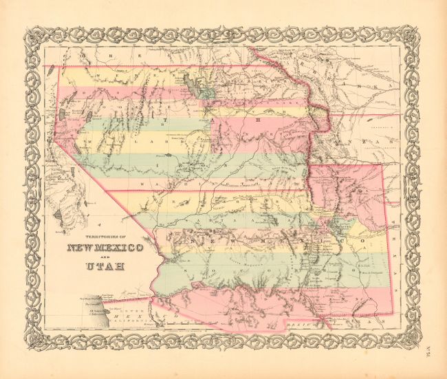
A very interesting map depicting the region with the largest extents of Utah and New Mexico territories. Utah Territory encompasses all of today's Nevada and extends west to the Continental Divide into present-day northern Colorado with Fillmore City as it's capital. New Mexico Territory includes part of southern Colorado and stretches west to include Arizona and the southern tip of present-day Nevada. Locates Fremont's routes, proposed routes for the Pacific Railroad, the Spanish Trail, and much more. A fine example of a very desirable map that Wheat found important enough to use as the frontispiece to Volume 4 of his Mapping the Transmississippi West. Decorative border. Includes descriptive text leaf. Published in 1856.
References: Wheat (TMW) #832 (frontispiece); Phillips & LeGear #816, 6116, 6125.
Condition: A
Good color and impression. Light marginal toning and a few spots.