Catalog Archive
Auction 108, Lot 111

"Accurata delineatio celeberrimae Regionis Ludovicianae vel Gallice Louisiane ol Canadae et Floridae adpellatione in Septemtrionali America descripta quae hodie nomine fluminis Mississippi vel St. Louis…", Seutter, Matthias

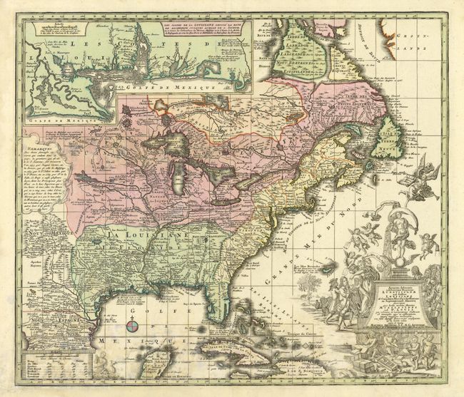
Subject: Colonial North America and Caribbean

Period: 1740 (circa)

Publication:

Color: Hand Color

Size:
22.5 x 19.5 inches
57.2 x 49.5 cm
Download High Resolution Image
(or just click on image to launch the Zoom viewer)

Bold map of the eastern part of North America focusing on the Mississippi River and the Great Lakes. Like many maps of the period, Labrador and Baffin Island are rather confused. A large inset of the Gulf Coast shows many forts and Indian villages. The most interesting feature of the map is the elaborate title cartouche. It depicts an allegorical scene of the infamous Mississippi Bubble investment scheme with cherubs under the cartouche issuing stock for the company.

References: Portinaro & Knirsch #117.

Condition: C

Some damp stain and water damage in left portion of map, still an attractive map.

Estimate: $1,600 - $1,800

Sold for: $1,200

Closed on 9/29/2004

Archived