Catalog Archive
Auction 107, Lot 82

"L'Amerique Septentrionale Divisee en ses Principaux Etats", Laporte, Joseph de

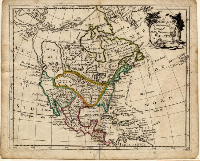
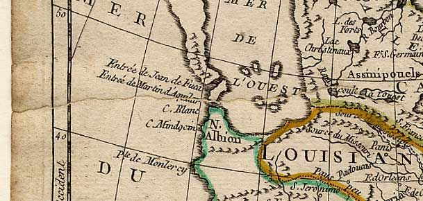
Subject: North America

Period: 1781 (circa)

Publication:

Color: Hand Color

Size:
8.6 x 7 inches
21.8 x 17.8 cm
Download High Resolution Image
(or just click on image to launch the Zoom viewer)

Great little map of the continent showing the imaginary Mer ou Baye de l'Ouest and a Northwest Passage stretching from Baffin Bay to the Archipel St. Lazare. There is not yet any sign of a recognizable Alaska. The British colonies are confined on the eastern seaboard with French Louisiana stretching to the Pacific Northwest. Title cartouche features two Native Americans. Apparently based on Janvier's map of the same title.

References:

Condition: B

Backed with Japanese tissue repairing a long tear at left. Bit of minor soil, still a nice example of an uncommon map.

Estimate: $275 - $325

Sold for: $200

Closed on 6/9/2004

Archived