Subject: South Pacific
Period: 1799 (dated)
Publication: A missionary voyage to the southern Pacific Ocean
Color: Hand Color
Size:
20.7 x 13.2 inches
52.6 x 33.5 cm
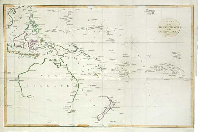
Nice map of the South Pacific showing the tracks of H.M.S. Duff. The ship, commanded by Capt. John Wilson, had aboard members of the London Missionary Society and their families, who were resettled in the South Pacific on the islands of Tahiti, Tonga and the Marquesas. During his travels Capt. Wilson discovered the archipelago of Mangareva, which he named Gambier in honor of the British admiral sponsoring the expedition. The map shows Australia's south coast incomplete and unexplored. The map covers from Hawaii to the coast of Vietnam in the north and from Australia and New Zealand through the Marquesas and the Dangerous Archipelago in the south.
References:
Condition: B
Issued folding, now pressed with folds reinforced with tissue on verso. Faint toning along a couple of folds.