Subject: England
Period: 1675 (circa)
Publication: Brittania
Color: Hand Color
Size:
17.5 x 13.7 inches
44.5 x 34.8 cm
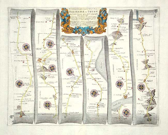
John Ogilby's 'Britannia' was published between 1675 and 1698. It is a landmark in the mapping of England and Wales. Its unique format constituted the first national road-atlas of any country in Western Europe. It was composed of maps of seventy-three major roads and cross-roads, presented in a continuous strip-form, on a uniform scale of one inch to a mile. Each beautiful map includes wonderful detail of the countryside with each strip containing a large compass rose to indicate changes in direction.
A very nice strip-style road map that details the route between Hatherley and westward to Truro with a major crossing on the Camel River. Great detail including villages, bridges, river crossings, hills and much more. Decorated with numerous compass roses and a boldly engraved strapwork title cartouche.
References:
Condition: A
Later coloring.