Subject: Western United States & Mexico
Period: 1842 (dated)
Publication:
Color: Hand Color
Size:
15.5 x 12 inches
39.4 x 30.5 cm
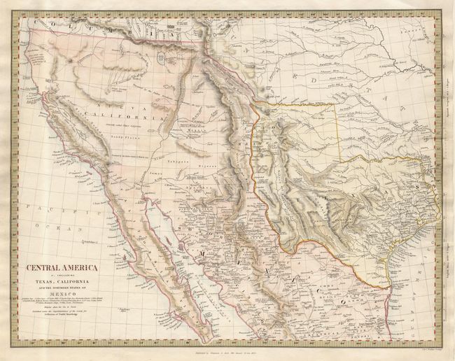
Despite the title, this map covers the Southwestern United States just a few years before Mexico lost the region in the Mexican/American War. Texas is shown as Independent with its panhandle extending well north up to Spanish Peaks. All of the Southwest and California are here noted as being "Generally called Upper California." Large swamp and lakes are shown in the Great Basin, draining through a complex R. Buenaventura system. Good detail throughout including forts, Indian tribes, etc. The map is filled with interesting notations including a "Supposed Petrified Forest" in the western part of Texas, and "Supposed residence of the Aztecs in 12th century (Humboldt)" in the Moquis (Hopi) region of present-day Arizona. Published by Chapman and Hall.
References: Day p. 37; Wheat [TMW] #460.
Condition: A