Catalog Archive
Auction 107, Lot 206

"Reconnaissance of Routes from San Antonio de Bexar to El Paso del Norte &c.", U.S. War Department
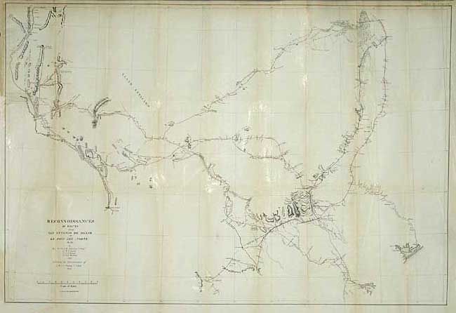
Subject: Texas

Period: 1849 (dated)

Publication: Senate ex doc 61 31st Congress. 1st Session

Color: Printed Color

Size:
36.6 x 24.6 inches
93 x 62.5 cm
Download High Resolution Image
(or just click on image to launch the Zoom viewer)

Map covers the region of Texas between the Rio Grande at left and east to include Matagorda Bay, Preston and Fort Washita. Good detail along routes, especially around San Antonio de Bexar, and mostly blank elsewhere. Shows a reconnaissance of 1849 in red and Lt. Whiting's route in blue. Filled with geographical information, forts, presidios, springs, fords, watering holes and much more.

References: Wheat [TMW] #677.

Condition: B

Backed with archival tissue. A little fold toning and one fold intersection with a small tape repair.

Estimate: $250 - $300

Sold for: $170

Closed on 6/9/2004

Archived