Subject: New York
Period: 1857-74 (dated)
Publication:
Color: Black & White
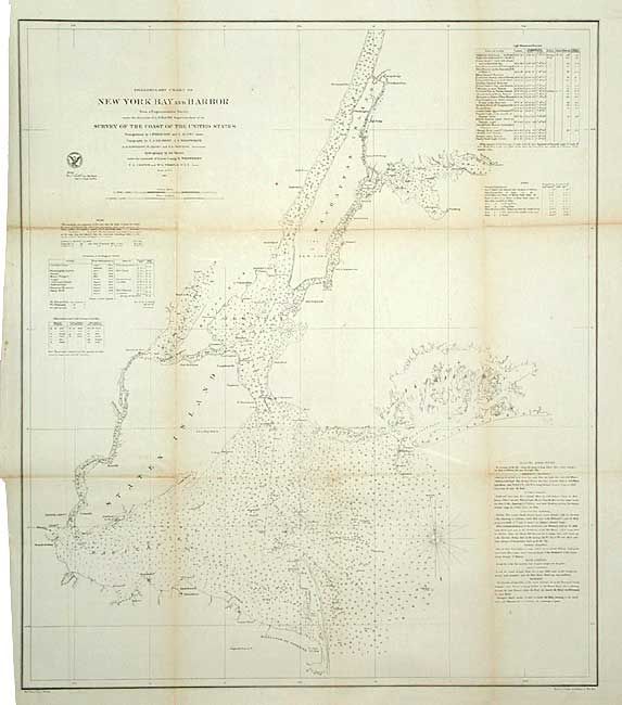
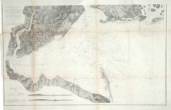
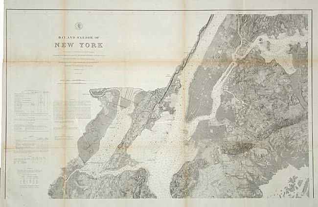
First map, Bay and Harbor of New York, 1874 is on two sheets (each 40 x 24.5"). Together they cover the waterways from upper Manhattan south to Raritan Bay and Sandy Hook. Extremely well detailed throughout the coastal and interior area, including streets and even individual buildings. Staten Island is well developed. Insets at bottom show two offshore views of the Highland Lights, the light ship and Sandy Hook Light from different bearings. If joined the map would measure 40" x 48". The second map, Preliminary Chart of New York Bay and Harbor, 1857 (26.5 x 30.5") is filled with soundings, navigation notes, etc. Shows all of Manhattan Island and extends to include Staten Island, Jamaica Bay, and part of the Highlands of Nevesink.
References:
Condition: B
All backed with archival tissue. Toning along folds.