Catalog Archive
Auction 107, Lot 186

"Custer's Battle-field (June 25th 1876) Surveyed and Drawn Under the personal supervision of Lieut. Edward Maguire Corps of Engineers U.S.A. by Sergeant Charles Becker", Maguire, Lieut. Edward
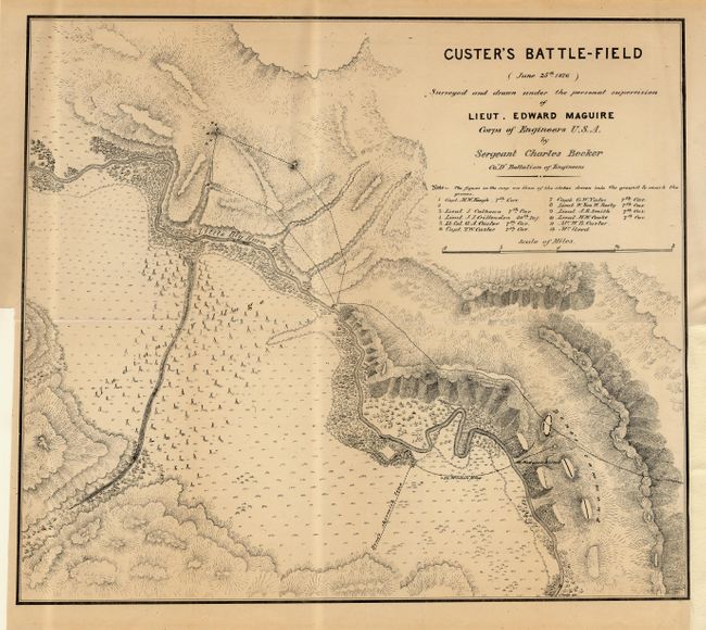
Subject: Montana

Period: 1876 (dated)

Publication:

Color: Black & White

Size:
17.5 x 15 inches
44.5 x 38.1 cm
Download High Resolution Image
(or just click on image to launch the Zoom viewer)

An excellent terrain map of the scene of Custer's defeat that was made shortly after the infamous massacre. Macquire was attached to a column that came to Reno's rescue and upon departure of the hostile Indians proceeded to the scene of the Custer disaster. The report (not included) gave his short synopsis of the troop operations leading up to this historic engagement. Drawn by Sergeant Charles Becker, the map details the position of 12 fallen soldiers and officers. Locates the Indian Village, course of the Little Big Horn River, Reno's skirmish line and much more of interest.

References: Wheat (TMW) #1266.

Condition: B

Issued folding, now tissue backed. Lower right margin added for framing.

Estimate: $240 - $275

Sold for: $650

Closed on 6/9/2004

Archived