Subject: Dakota
Period: 1882 (dated)
Publication: Sen. Doc. #283, 48th Congress 1st Sess.
Color: Printed Color
Size:
23.8 x 29 inches
60.5 x 73.7 cm
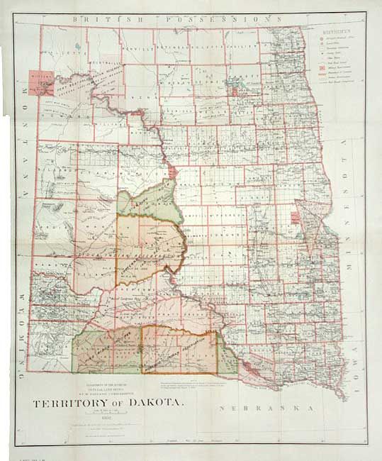
A striking county map of the territory showing the location of military and Indian Reservations, railroads, extent of Northern Pacific Railroad land grants, cities, towns and county seats. The majority of the western portion of the territory is devoted to Indian Reservations. Economic development is still largely limited to the eastern regions. By 1880 cattlemen [many from Texas] occupied most of the range in Dakota. Bismarck is shown as the capital. Detailed and beautifully lithographed by Bien.
References:
Condition: A
Issued folding, now backed with archival tissue. A trace of toning, still very good for a map of this size.