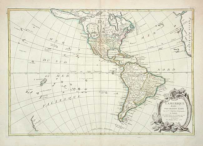
Subject: Western Hemisphere
Period: 1762 (dated)
Publication:
Color: Hand Color
Size:
17.5 x 11.9 inches
44.5 x 30.2 cm
A fine map of the Americas that features a huge, imaginary, Sea of the West and hints of a possible Northwest Passage. Alaska is shown in an early configuration with a rough shape incorporating the Aleutians, and notations concerning the coastline discoveries in 1741 by the Russians. There are several islands shown in the Pacific and just the western coastline of New Zealand. In North America, the British colonies are shown east of the mountains, French Louisiana takes in most of the interior and Spain controls Florida. A handsome map with a decorative rococo-style title cartouche, uncolored as issued.
References:
Condition: B
Original coloring on a full sheet of hand laid paper with wide margins. Large watermark of a rosary. A little light scattered foxing, else very good.