Subject: Western Hemisphere
Period: 1652 (circa)
Publication: Niewen Atlas
Color: Hand Color
Size:
19.7 x 14.9 inches
50 x 37.8 cm
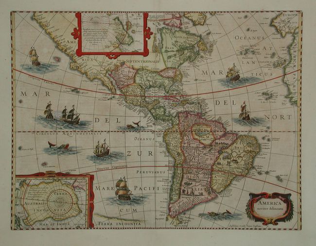
State 5 of this important map of the New World. First engraved by Jodocus Hondius in 1618, the plate eventually came into the possession of Jansson who removed Hondius' imprint from the cartouche and added "Amstelodami, Excudit Joannes Ianssonius (lower left of the cartouche). There are two stylized inset maps of the two polar regions. The North Pole depicts Frobisher's theory of the Northwest Passage and the South Pole shows the long-held notion of the mythical southern continent. The map is richly ornamented with a strapwork title cartouche, fleets of ships and sea monsters. North America retains the peninsular California and the east coast is beginning to take shape, although it still lacks the detail in the mid-Atlantic region. In South America there is a large inland sea and two engraved scenes, one of which details a cannibalistic feast. Dutch text on verso.
References: Burden #192 and Goss (NA) #27; Tooley (America) p.299.
Condition: A
Slight uneven toning, overall very good with fine impression and lovely period style coloring.