Subject: Exploration and Surveys
Period: 1860 (published)
Publication:
Color:
Size:
9.5 x 11.2 inches
24.1 x 28.4 cm
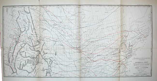
This volume describes Steven’s explorations from St. Paul to Puget Sound and contains his general narrative and final report and a superb collection of lithographs by John Mix Stanley, the expedition artist. Among the important lithographs are those that depict St. Paul, Fort Union, Fort Benton, Blackfeet Indians, Fort Owen, Nez Perces, Mount Rainier, and Cantonment Stevens (Corvallis). Included are the one of Hellgate (Missoula before there was a settlement), of the Big Hole Valley in Montana, and of the Great Falls of the Missouri. Seventy tinted lithographs, two folding charts (Isothermal Chart of the Region .…. between the Atlantic & Pacific Oceans, and General Rail-road Profile), lacking the map from Milk River to the Columbia. Tall 4to, 358 pp., appendices and index, 41 pp. House Ex. Doc. No. 56, Vol. 12 pt. 1, 36th Cong. 1st Session, 1859-60. Original cloth binding, endpapers replaced. Ex-libris with bookplate on front pastedown.
References:
Condition: B
Generally clean with some very light foxing and a few pencil notes. The plates are in very good to fine condition with light foxing confined to paper edges. Charts with some repaired tears with tape stains.