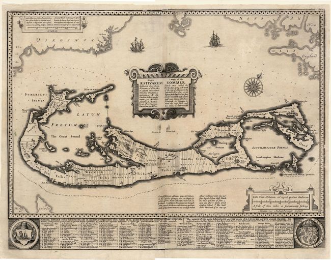
Subject: Bermuda
Period: 1626 (circa)
Publication:
Color: Black & White
Size:
21.2 x 13.7 inches
53.8 x 34.8 cm
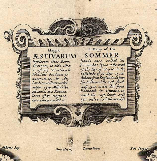
An extremely rare proof state of this important map of Bermuda. Compiled in 1622 by Richard Norwood, this is the first English printed map published in an atlas that showed Bermuda divided into Tribes and Shares. These divisions designated the properties given to the 'Adventurers,' led by Sir George Sommers, who were shipwrecked there in 1609. Speed's map became the standard map of the 17th century and was copied by Blaeu, Jansson, Ogilby and others. Title in both English and Latin. No text on verso. The map was beautifully engraved by Abraham Goos in Amsterdam for Speed's Prospect and his signature appears below the scale of miles. The imprint of George Humble was added at a later time and is missing from this example. The copy in the British Library is the only other known proof state. Even with faults, this is an extremely important map.
References: Imago Mundi #40, p.140; Palmer (MCC-19) #6.
Condition: B
Fine impression. Expert and professional repairs including the replacement (leaf-caster method) of paper at centerfold with slight loss of text in the title cartouche and the small island of Bermuda under the cartouche. A few other minor repairs.