Subject: Atlantic
Period: 1794 (dated)
Publication:
Color: Hand Color
Size:
24 x 18 inches
61 x 45.7 cm
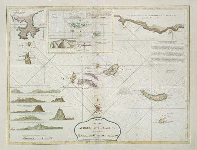
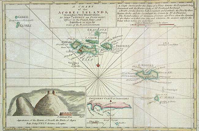
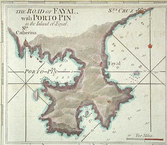
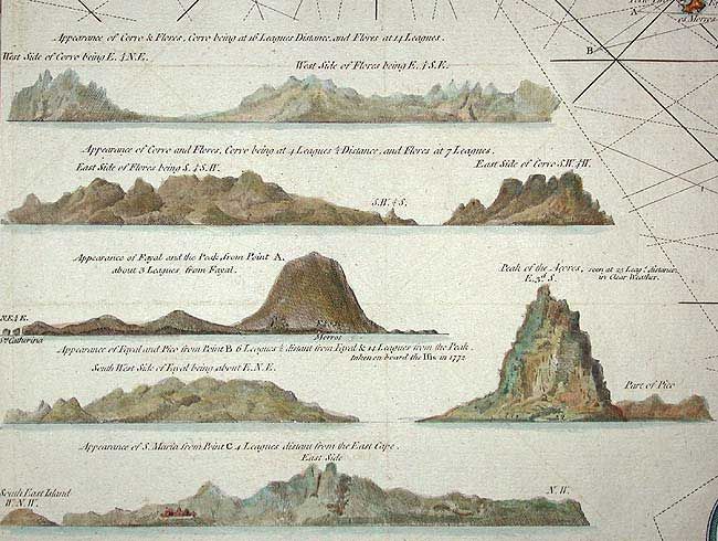
Fine nautical chart showing all the islands with currents, rhumb lines, anchorages, etc. Relief is shown by hachures. Includes 6 coastal profiles and inset maps: The road of Rayal with Porto Pin in the Island of Fayal; The Roads of Punta Delgada and Villa Franca in the Isle of S. Miguel; A Chart of the Acores Islands, drawn from new observations by Monsr. d'Eveux de Fleurieu, officer in the French Navy, and published in 1772, by order of the French government. The last with coastal profile and inset map of the Southern Coast of Terceira. The title cartouche incorporates a fine compass rose.
References:
Condition: B
Toned along centerfold, else very good. Tissue repairs in blank margins.