Catalog Archive
Auction 106, Lot 248
"Plan of the Town & Fort of Grenada . By Mr. De Caylus, Engineer General of the French Islands", Caylus
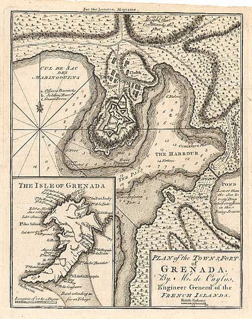
Subject: Grenada
Period: 1762 (published)
Publication: London Magazine
Color: Black & White
Size:
6.9 x 8.8 inches
17.5 x 22.4 cm
Download High Resolution Image
(or just click on image to launch the Zoom viewer)
(or just click on image to launch the Zoom viewer)