Subject: World
Period: 1730 (circa)
Publication:
Color: Hand Color
Size:
18.6 x 15.7 inches
47.2 x 39.9 cm
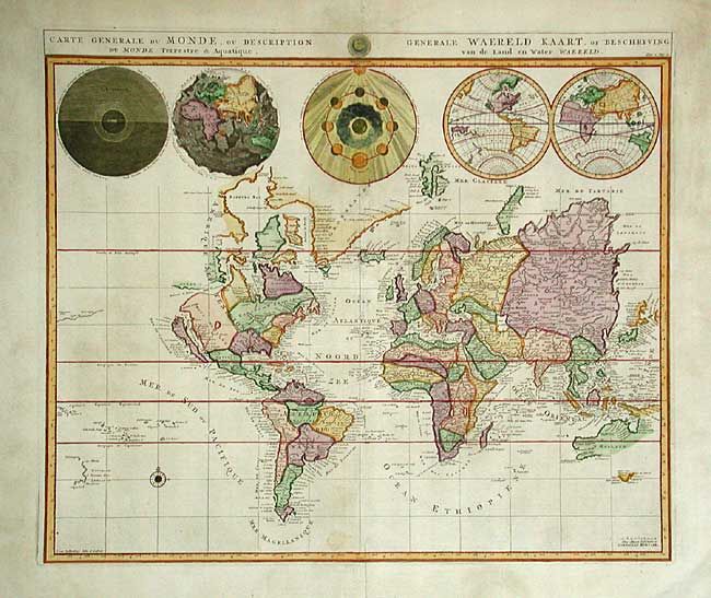
Pierre Mortier's unique world map drawn on Mercator's projection with California as an Island and the Detroit d'Anian connected by dotted lines through the Northwest Passage to Button's Bay located to the west of Hudson Bay. A small coastline of New Zealand appears in the Pacific. The northeast coast of Asia is severely truncated and shows Witsen's Cap de Glaces. Australia's northern coast is shown connected to New Guinea, along with a part of Van Diemen's Land. The most interesting features of the map are the five spheres presented at top. These depict Day and Night, the Flood, the phases of the moon, and the Western and Eastern Hemispheres. The map was precisely engraved by Jan van Luchenburg (signature at lower left). This is the second state with the Covens and Mortier imprint. Dutch title: Generale Waereld Kaart, of Beschryving van de Land en water Waereld.
References: Shirley #622.
Condition: B
Couple of faint spots. Professional repairs on several minor tears in blank margins, well away from map.