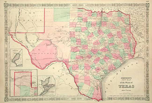
Subject: Texas
Period: 1863 (published)
Publication:
Color: Hand Color
Size:
24.3 x 16.5 inches
61.7 x 41.9 cm
Handsome and large map with county development mostly in eastern Texas and only the three large counties of El Paso, Presidio, and Bexar in the west. The panhandle, noted as the Staked Plains (Elevated Table Land, without Wood or Water), includes a large section that is unorganized. Nice depiction of the wagon roads, many named, with several completed railroads including the Houston & Guaymas R.R. Insets include a Plan of Sabine Lake, Plan of the Northern part of Texas, and Plan of Galveston Bay. Decorative scrollwork border.
References:
Condition: B
Fine coloring and impression. Trace of offsetting in ocean, long split at top, now invisible and expertly repaired, still very good.