Catalog Archive
Auction 106, Lot 200

"New Map of the State of Minnesota showing the Saint Paul, Minneapolis and Manitoba Railway and its Connections", Railroad Companies, (Various)
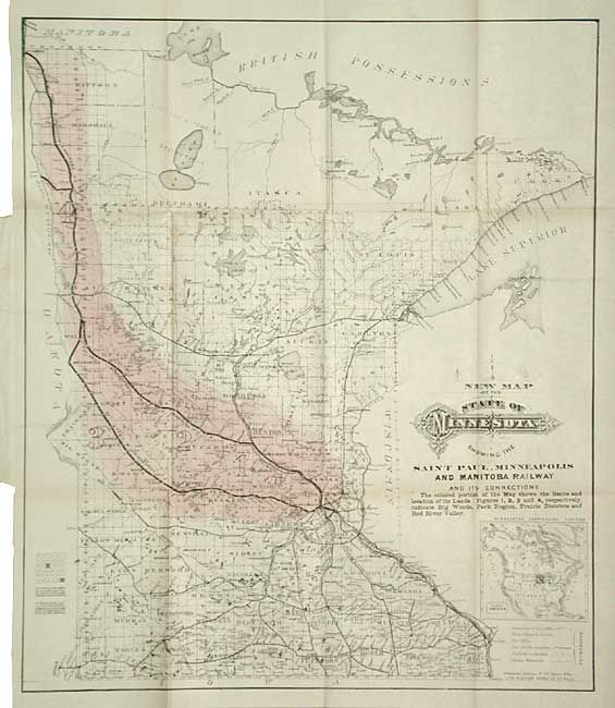
Subject: Minnesota

Period: 1879 (dated)

Publication: St. Paul, Minneapolis & Manitoba Railway Co.

Color: Hand Color

Size:
16.7 x 19.7 inches
42.4 x 50 cm
Download High Resolution Image
(or just click on image to launch the Zoom viewer)

This is a great map delineating the lands for sale on the railway corridor from St. Paul to the Canadian border. An inset below the fancy title shows the location of Minnesota in North America. The map was published with the accompanying booklet for immigrants titled, "Facts about Minnesota condensed and compiled from official records - reliable, practical Information for Immigrants." 48 pp., filled with information including the cost of coming to Minnesota from various locations in Europe and the United States.

References:

Condition: A

Map detached. Paper covers of booklet with minor soil, split on spine and detached. Overall very good condition for ephemeral.

Estimate: $150 - $200

Sold for: $150

Closed on 3/3/2004

Archived