Catalog Archive
Auction 106, Lot 167

"Sketch of Public Surveys in New Mexico", U.S. State Surveys

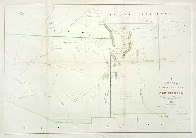
Subject: United States - Southwestern - New Mexico and Arizona

Period: 1856 (dated)

Publication:

Color: Hand Color

Size:
32.7 x 22.5 inches
83.1 x 57.2 cm
Download High Resolution Image
(or just click on image to launch the Zoom viewer)

Early, large-scale, territorial map by the Surveyor Generals Office, Santa Fe New Mexico. Shows the territory in its fullest extent including all of present-day Arizona and parts of Nevada and Colorado. This maps expands slightly on the first public surveys of 1855 with the addition of three small surveys completed east of Santa Fe. Locates numerous Indian villages and reservations with very limited detail outside of the towns along the Principal and Guide Meridians.

References:

Condition: B

Modern color. Backed with archival tissue, reattaching torn left corner and repairing several tears. Light toning along folds.

Estimate: $150 - $200

Sold for: $180

Closed on 3/3/2004

Archived