Subject: United States - Southwestern
Period: 1858 (dated)
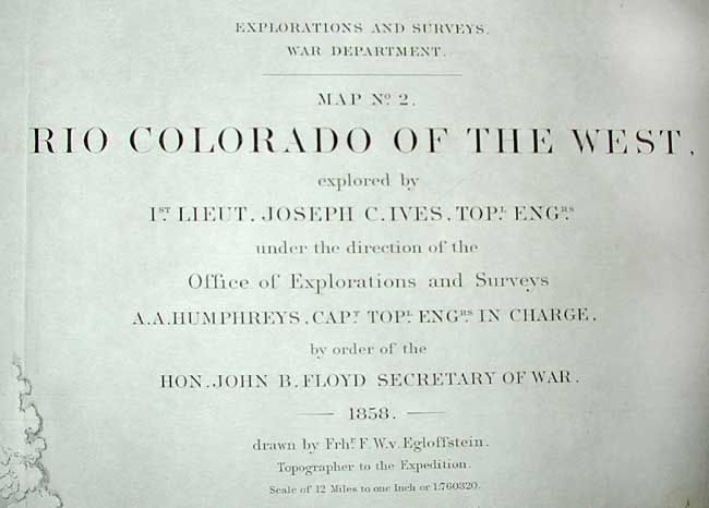
Publication: Report upon the Colorado River of the West
Color: Black & White
Size:
34.7 x 14.5 inches
88.1 x 36.8 cm
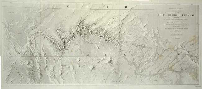
This map is the second in a series of four that represent one of the most important exploring efforts of the American Southwest. It details the region around the Grand Canyon and Little Colorado River using Eggloffstein's unique 3-D like technique. The map shows the river from about Needles (Whipple's Crossing and Mojave Canyon) north through Black Canyon, to the Little Colorado and then north to beyond the survey's limit as the riverbed fades to nothing. Carl Wheat devotes several pages to this map and the process used to product it. Finely and fully engraved the map locates Fort Defiance, Campbell's Pass, Zuni, Moquis (Hopi) Pueblos, San Francisco Springs (Flagstaff), Las Vegas, the Mormon Road, numerous Indian tribes, and much more. Several important exploration routes & trails are shown including The Old Spanish Trail, Whipple's trail 1854-4 and Beale's trail.
References: Wheat (TMW) 948.
Condition: B
With a few faint stains, else very good.