Catalog Archive
Auction 106, Lot 118

"A Chart of the Gulf of St. Laurence, Composed From a Great Number of Actual Surveys and other Materials, Regulated and Connected by Astronomical Observations", Jefferys/Sayer & Bennett
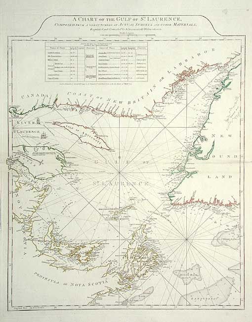
Subject: Canada

Period: 1775 (dated)

Publication: American Atlas

Color: Hand Color

Size:
19.5 x 24 inches
49.5 x 61 cm
Download High Resolution Image
(or just click on image to launch the Zoom viewer)

Handsome sailing chart of the gulf, embracing Nova Scotia, Newfoundland and New Britain, complete with rhumb lines, soundings, shoals and numerous notations. The coastlines are presented in great detail with a profusion of harbors and ports being named. A table of Astronomical Observations lists the latitude and longitude of various major ports. This is an excellent example of the work of Thomas Jeffreys, one of the most outstanding English cartographers of the late 18th century.

References: Kershaw #597, Phillips (M) p. 762.

Condition: A

Few tears in blank margins, all with expert repairs.

Estimate: $475 - $550

Sold for: $475

Closed on 3/3/2004

Archived