Subject: Western North America
Period: 1799 (circa)
Publication:
Color: Black & White
Size:
23 x 29 inches
58.4 x 73.7 cm
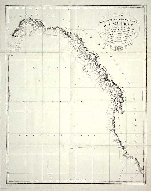
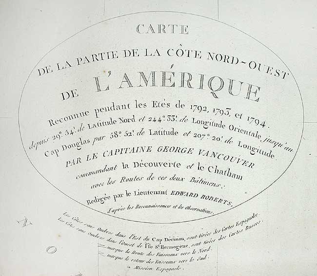
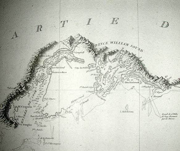
A remarkably detailed chart covering all of Vancouver's expeditions of 1792-94. These expeditions finally closed the door on the idea of a Northwest Passage and opened the region to commerce and the fur trade. His charts of the lower Columbia River were used by Lewis and Clark in the next decade. This chart includes the entire west coast from well below San Diego north to Cook Inlet and Kodiak Island in Alaska. Very fine detail names Port St. Francisco, Monterey Bay, C. Mendocino, C. Fairweather and much more. Good detail up the Columbia River to Pte. Vancouver. Shows the track of his expeditions and locates scores of place names. Drawn by Lieutenant Edward Roberts and engraved by Blondeau. A desirable chart that is seldom offered in this large size.
References:
Condition: A
A few small spots, still very good. On thick hand laid paper with deckled edges, folding as issued. Large and beautiful watermark