Subject: North America
Period: 1795 (dated)
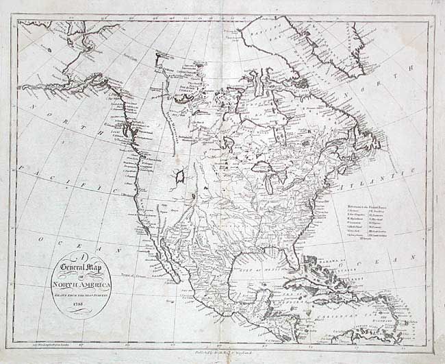
Publication: Winterbotham's America
Color: Black & White
Size:
18 x 14.4 inches
45.7 x 36.6 cm
An interesting map of the continent copied from John Russell's map of the previous year. In the northwest is a long mountain range labeled Stony Mountains and a notation in the far north locating "Mountains with bright stones." Locates Hearne (1771) and Mackenzie (1789) discoveries in the Arctic. There is a large, unnamed, lake in the vicinity of Great Salt Lake, but this region is otherwise blank. Dotted lines delineate the fifteen states of the young United States with the Mississippi River forming its western boundary. First state published in 1796 with the imprint of Smith, Reid & Wayland at bottom.
References: Wheat & Brun #57; Wheat [TMW] #233.
Condition: B
Repair along top fold including tissue replacement of some paper loss and facsimile of neatlines. Some light foxing and damp stains.